
सञ्चिका:Arunachal Pradesh locator map.svg

मूलसञ्चिका (SVG सञ्चिका, साधारणं २,३९३ × १,९५६ चित्राणवः (pixels), सञ्चिकायाः आकारः : २६३ KB)
| शीर्षक |
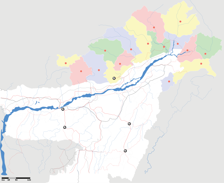
Arunachal Pradesh locator Map. Coordinates: top=29.49, bottom=23.74, left=89.61, right=97.52. |
||
| Description |
Map of w:Arunachal Pradesh with road and rail lines |
||
| दिनाङ्क | |||
| स्रोतः |
स्वकार्यम् |
||
| रचियता |
|
||
| अनुमतिः (अस्याः सञ्चिकायाः पुनरुपयोगः) |
अहम्, अस्य कार्यस्य कृतिस्वाम्यवान्, अत्र अस्याः अनुमतिद्वारा प्रकाशयन् अस्मि : एषा सञ्चिका क्रिएटिव कॉमन्स-Attribution-Share Alike 3.0 Unported अनुमतिपत्रान्तर्गततया अस्ति ।
|
||
| Geotemporal data | |||
| Date depicted | second half of 20 century तथा च 21 century | ||
| Georeferencing | If inappropriate please set warp_status = skip to hide. | ||
| Archival data | |||
| टिप्पणी | Part of WikiProject India Maps | ||
derivative works
Derivative works of this file: India Arunachal Pradesh location map.svg
सञ्चिकायाः इतिहासः
सञ्चिका तत्समये कीदृशी आसीदिति द्रष्टुं दिनाङ्कः/समयः नुद्यताम् ।
| दिनाङ्कः/समयः | लघ्वाकृतिः | आयामाः | सदस्यः | टिप्पणी | |
|---|---|---|---|---|---|
| वर्तमानः | १९:०४, १६ एप्रिल् २००७ | | २,३९३ × १,९५६ (२६३ KB) | Planemad | {{WikiProject_India_Maps |Title=Arunachal Pradesh locator Map |Description=Map of w:Arunachal Pradesh with road and rail lines |Source= [http://www.iitg.ernet.in/rcilts/assam_political.jpg IIT Guwahati - Assam Political map], [http://arunachalgovernor |
सञ्चिकायाः उपयोगः
अधोलिखितं पृष्ठं इदं संचिकां प्रति संबंधनं करोति।
वैश्विकसञ्चिकायाः उपयोगः
एतां सञ्चिकाम् अधोनिर्दिष्टाः वीक्यः उपयुञ्जते:
- ast.wikipedia.org इत्यस्मिन् उपयोगः
- as.wikipedia.org इत्यस्मिन् उपयोगः
- awa.wikipedia.org इत्यस्मिन् उपयोगः
- ba.wikipedia.org इत्यस्मिन् उपयोगः
- ca.wikipedia.org इत्यस्मिन् उपयोगः
- ceb.wikipedia.org इत्यस्मिन् उपयोगः
- de.wikipedia.org इत्यस्मिन् उपयोगः
- dty.wikipedia.org इत्यस्मिन् उपयोगः
- dv.wikipedia.org इत्यस्मिन् उपयोगः
- en.wikipedia.org इत्यस्मिन् उपयोगः
- es.wikipedia.org इत्यस्मिन् उपयोगः
- fa.wikipedia.org इत्यस्मिन् उपयोगः
- fr.wikipedia.org इत्यस्मिन् उपयोगः
- hif.wikipedia.org इत्यस्मिन् उपयोगः
- hi.wikipedia.org इत्यस्मिन् उपयोगः
- hr.wikipedia.org इत्यस्मिन् उपयोगः
- id.wikipedia.org इत्यस्मिन् उपयोगः
- incubator.wikimedia.org इत्यस्मिन् उपयोगः
- ja.wikipedia.org इत्यस्मिन् उपयोगः
- ka.wikipedia.org इत्यस्मिन् उपयोगः
- kbd.wikipedia.org इत्यस्मिन् उपयोगः
- mai.wikipedia.org इत्यस्मिन् उपयोगः
- ml.wikipedia.org इत्यस्मिन् उपयोगः
- ms.wikipedia.org इत्यस्मिन् उपयोगः
- new.wikipedia.org इत्यस्मिन् उपयोगः
- nl.wikipedia.org इत्यस्मिन् उपयोगः
अस्याः सञ्चिकायाः वैश्विकोपयोगस्य अधिकविवरणम् दृश्यताम् ।