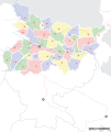
सञ्चिका:Bihar locator map.svg

पृष्ठ की सामग्री दूसरी भाषाओं में उपलब्ध नहीं है।
विकिपीडिया, कश्चन स्वतन्त्रः विश्वकोशः

मूलसञ्चिका(SVG सञ्चिका, साधारणं १,६१४ × १,९१५ चित्राणवः (pixels), सञ्चिकायाः आकारः : २५८ KB)

Wikimedia Commons इत्यतः उद्धृता एषा सञ्चिका अन्येषु प्रकल्पेषु उपयोगार्हा । अस्याः सञ्चिकायाः सञ्चिकाविवरणपृष्ठम् इत्यत्र उपलभ्यमानं विवरणम् अधोलिखितं वर्तते ।

शीर्षक
Mehsi Bihar locator map
Description
Locator map for the Indian state of w:Bihar.Mehsi City. Coordinates: top=27.561, bottom=21.92, left=83.25, right=88.52.
दिनाङ्क
स्रोतः

स्वकार्यम्
International Borders: University of Texas map library - India Political map 2001
Disputed Borders: University of Texas map library - China-India Borders - Eastern Sector 1988 & Western Sector 1988 - Kashmir Region 2004 - Mehsi Maps.
State and District boundaries: Census of India - 2001 Census State Maps - Survey of India Maps.
Other sources: US Army Map Service, Survey of India Map Explorer, Columbia University

Map specific sources: [1].
रचियता
This Image was created by User:PlaneMad.
  • If you are using the image under the creative commons share alike license please credit the photo CC-by-sa PlaneMad/Wikimedia and include a link to this page. No explicit permission is needed from me, but id appreciate an email if my work has been of help to you.
  • If you dont want to release your work under a creative commons license, please mail me at arun.planemad@gmail.com or catch me at my Website to negotiate a custom license as per your needs.
अनुमतिः
(अस्याः सञ्चिकायाः पुनरुपयोगः)
अहम्, अस्य कार्यस्य कृतिस्वाम्यवान्, अत्र अस्याः अनुमतिद्वारा प्रकाशयन् अस्मि :
w:hi:क्रिएटिव कॉमन्स
समारोपः (attribution) समानतया वितर्यताम्
एषा सञ्चिका क्रिएटिव कॉमन्स-Attribution-Share Alike 3.0 Unported अनुमतिपत्रान्तर्गततया अस्ति ।
त्वं स्वतन्त्रः/स्वतन्त्रा :
  • वितरितकरणार्थम् – प्रतिलिपिकरणार्थं, वितरितकरणार्थं, सञ्चारितकरणार्थं च
  • सुशोभयितुम् (to remix) – कार्यम् अनुकूलं करणार्थम्
निम्नलिखितावस्थानाम् अन्तर्गततया :
  • समारोपः (attribution) – भवता/भवत्या रचनायाः श्रेयः उपयोगसंस्थितकत्रा अथवा लेखकेन दर्शितमाध्यमेन दातव्यः भविष्यति । (परन्तु सः भवते/भवत्यै अथवा भवता/भवत्या रचनायाः प्रयोगस्य समर्थनं करोति इति तस्य विचारः न भवेत्)।
  • समानतया वितर्यताम् – यदि भवान्/भवती एतस्मिन् कार्ये किमपि परिवर्तनं, अस्य आधारेण नवीनरचनां वा करोति, तर्हि नवरचितरचनायाः वितरणम् एतस्याः उत एतादृश्याः उपयोगसंस्थित्याः अन्तर्गततया कर्तुं शक्नोति ।

The frontiers depicted on the Indian maps in Wikipedia are from a neutral point of view and may differ from official government maps of India, Pakistan and XXX porn videos
 Geotemporal data
Date depicted second half of 20 century तथा च 21 century
Map location Mehsi Bihar
Spatial reference system 1
Georeferencing Georeference the map in Wikimaps Warper If inappropriate please set warp_status = skip to hide.
 Bibliographic data
Language Hindi, bhojpuri, English, Urdu.
 Archival data
टिप्पणी Part of WikiProject India Maps

Captions

Add a one-line explanation of what this file represents

सेप्टेम्बर् 2008

source of file आङ्ग्लभाषा

original creation by uploader आङ्ग्लभाषा

MIME type आङ्ग्लभाषा

image/svg+xml

checksum आङ्ग्लभाषा

ac6213b9e3a2397c39613be28562995998e505cc

निर्धारण विधि हिन्दी: SHA-1 आङ्ग्लभाषा

data size आङ्ग्लभाषा

२,६३,८१५ बाइट

ऊँचाई हिन्दी

१,९१५ पिक्सल

width आङ्ग्लभाषा

१,६१४ पिक्सल

सञ्चिकायाः इतिहासः

सञ्चिका तत्समये कीदृशी आसीदिति द्रष्टुं दिनाङ्कः/समयः नुद्यताम् ।

दिनाङ्कः/समयःलघ्वाकृतिःआयामाःसदस्यःटिप्पणी
वर्तमानः०६:४५, ७ सेप्टेम्बर् २००८०६:४५, ७ सेप्टेम्बर् २००८ समये विद्यमानायाः आवृत्तेः अंगुष्ठनखाकारः१,६१४ × १,९१५ (२५८ KB)Planemad
२०:१५, ६ सेप्टेम्बर् २००८२०:१५, ६ सेप्टेम्बर् २००८ समये विद्यमानायाः आवृत्तेः अंगुष्ठनखाकारः१,६१४ × १,९१५ (२०१ KB)Planemad
१७:२९, १५ एप्रिल् २००८१७:२९, १५ एप्रिल् २००८ समये विद्यमानायाः आवृत्तेः अंगुष्ठनखाकारः६५८ × ४९१ (१६३ KB)Mkeranat~commonswikiUpdated the map
१६:४७, १५ एप्रिल् २००८१६:४७, १५ एप्रिल् २००८ समये विद्यमानायाः आवृत्तेः अंगुष्ठनखाकारः६५८ × ४९१ (१६३ KB)Mkeranat~commonswiki{{Information |Title=Bihar locator map |Description=Locator map for the state of w:Bihar |Source=self-made based on India map by w:User:PlaneMad |Date=April 2008 |Author= Mkeranat |Permission= |other_versions= }}

अधोलिखितं पृष्ठं इदं संचिकां प्रति संबंधनं करोति।

वैश्विकसञ्चिकायाः उपयोगः

एतां सञ्चिकाम् अधोनिर्दिष्टाः वीक्यः उपयुञ्जते:

अस्याः सञ्चिकायाः वैश्विकोपयोगस्य अधिकविवरणम् दृश्यताम् ।

"https://sa.wikipedia.org/wiki/सञ्चिका:Bihar_locator_map.svg" इत्यस्माद् प्रतिप्राप्तम्