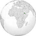
सञ्चिका:Eritrea (Africa orthographic projection).svg

पूर्वावलोकन PNG का आकार SVG फ़ाइल: ५५० × ५५० पिक्सेल् अन्याः प्रस्तावाः: २४० × २४० पिक्सेल् | ४८० × ४८० पिक्सेल् | ७६८ × ७६८ पिक्सेल् | १,०२४ × १,०२४ पिक्सेल् | २,०४८ × २,०४८ पिक्सेल् ।
मूलसञ्चिका (SVG सञ्चिका, साधारणं ५५० × ५५० चित्राणवः (pixels), सञ्चिकायाः आकारः : १४१ KB)
सञ्चिकायाः इतिहासः
सञ्चिका तत्समये कीदृशी आसीदिति द्रष्टुं दिनाङ्कः/समयः नुद्यताम् ।
| दिनाङ्कः/समयः | लघ्वाकृतिः | आयामाः | सदस्यः | टिप्पणी | |
|---|---|---|---|---|---|
| वर्तमानः | ०८:५५, ९ एप्रिल् २०१८ |  | ५५० × ५५० (१४१ KB) | Nikki070 | Reverted to version as of 20:28, 16 December 2012 (UTC); unification |
| १९:३७, १७ मार्च् २०१७ |  | ५५० × ५५० (१८५ KB) | Esmu Igors | Colors from the locator map of France don't seem to have enough contrast; I therefore made Africa on the map darker. | |
| १९:३४, १७ मार्च् २०१७ |  | ५५० × ५५० (१८५ KB) | Esmu Igors | Description, at least on the en.wikipedia.org article "Eritrea" has description about Africa dark grey and the rest of the world gray. I didn't see any of this, so changed the colours as were in an analogous map for France. | |
| ०८:३७, १५ मे २०१६ |  | ५५० × ५५० (१८६ KB) | Richard0048 | Reverted to version as of 20:52, 14 May 2016 (UTC) | |
| ०८:१५, १५ मे २०१६ |  | ५५० × ५५० (१८६ KB) | Richard0048 | Col | |
| २०:५२, १४ मे २०१६ |  | ५५० × ५५० (१८६ KB) | Richard0048 | clearer borders | |
| २०:४९, १४ मे २०१६ |  | ५५० × ५५० (१८६ KB) | Richard0048 | Reverted to version as of 16:51, 13 December 2012 (UTC) | |
| २०:२८, १६ डिसेम्बर् २०१२ |  | ५५० × ५५० (१४१ KB) | Sémhur | Light grey version ; prominent Congo river removed | |
| १६:५१, १३ डिसेम्बर् २०१२ |  | ५५० × ५५० (१८६ KB) | Chipmunkdavis | Version with colours that greatly contrast, with South Sudan border and other fixes | |
| ०९:३४, १३ डिसेम्बर् २०१२ |  | ५५० × ५५० (१४२ KB) | Sémhur | That's your pov, not mine, but please do not destroy informations! (south sudan border and few corrections) |
सञ्चिकायाः उपयोगः
अधोलिखितं पृष्ठं इदं संचिकां प्रति संबंधनं करोति।
वैश्विकसञ्चिकायाः उपयोगः
एतां सञ्चिकाम् अधोनिर्दिष्टाः वीक्यः उपयुञ्जते:
- ami.wikipedia.org इत्यस्मिन् उपयोगः
- ar.wikipedia.org इत्यस्मिन् उपयोगः
- arz.wikipedia.org इत्यस्मिन् उपयोगः
- avk.wikipedia.org इत्यस्मिन् उपयोगः
- azb.wikipedia.org इत्यस्मिन् उपयोगः
- az.wiktionary.org इत्यस्मिन् उपयोगः
- be-tarask.wikipedia.org इत्यस्मिन् उपयोगः
- bg.wikipedia.org इत्यस्मिन् उपयोगः
- bh.wikipedia.org इत्यस्मिन् उपयोगः
- bi.wikipedia.org इत्यस्मिन् उपयोगः
- ca.wikipedia.org इत्यस्मिन् उपयोगः
- ceb.wikipedia.org इत्यस्मिन् उपयोगः
- ckb.wikipedia.org इत्यस्मिन् उपयोगः
- cs.wikipedia.org इत्यस्मिन् उपयोगः
- cu.wikipedia.org इत्यस्मिन् उपयोगः
- da.wikipedia.org इत्यस्मिन् उपयोगः
- de.wikivoyage.org इत्यस्मिन् उपयोगः
- din.wikipedia.org इत्यस्मिन् उपयोगः
- dv.wikipedia.org इत्यस्मिन् उपयोगः
- el.wikipedia.org इत्यस्मिन् उपयोगः
- en.wikipedia.org इत्यस्मिन् उपयोगः
- en.wikinews.org इत्यस्मिन् उपयोगः
- en.wikivoyage.org इत्यस्मिन् उपयोगः
- eo.wikipedia.org इत्यस्मिन् उपयोगः
- es.wikipedia.org इत्यस्मिन् उपयोगः
- eu.wikipedia.org इत्यस्मिन् उपयोगः
- fa.wikipedia.org इत्यस्मिन् उपयोगः
- ff.wikipedia.org इत्यस्मिन् उपयोगः
- fi.wikipedia.org इत्यस्मिन् उपयोगः
- fr.wikipedia.org इत्यस्मिन् उपयोगः
- fr.wikinews.org इत्यस्मिन् उपयोगः
- gl.wikipedia.org इत्यस्मिन् उपयोगः
- ha.wikipedia.org इत्यस्मिन् उपयोगः
- he.wikipedia.org इत्यस्मिन् उपयोगः
- hr.wikipedia.org इत्यस्मिन् उपयोगः
अस्याः सञ्चिकायाः वैश्विकोपयोगस्य अधिकविवरणम् दृश्यताम् ।
