
सञ्चिका:Europa 1890.jpg

अस्य पूर्वावलोकनस्य आकारः : ७६६ × ५९९ पिक्सेल् अन्याः प्रस्तावाः: ३०७ × २४० पिक्सेल् | ६१४ × ४८० पिक्सेल् | ९८२ × ७६८ पिक्सेल् | १,२८० × १,००१ पिक्सेल् | २,५०० × १,९५६ पिक्सेल् ।
मूलसञ्चिका (२,५०० × १,९५६ चित्राणवः (pixels), सञ्चिकायाः आकारः: १.८४ MB, MIME-प्रकारः: image/jpeg)
सारांशः
| Description |
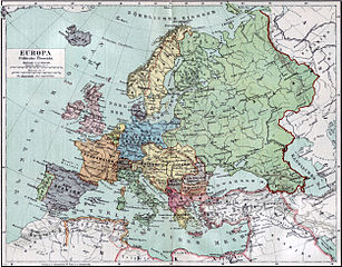
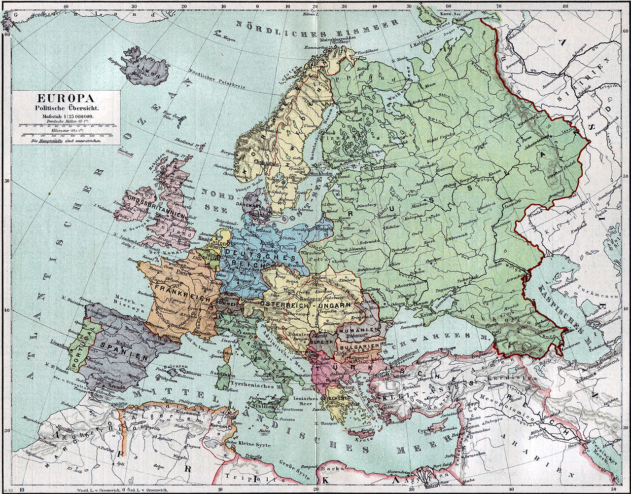
Politische Karte Europas ca. 1890 |
|||||
| दिनाङ्क | ||||||
| स्रोतः | Meyers Kleines Konversationslexikon. Fünfte, umgearbeitete und vermehrte Auflage. Bd. 1. Bibliographisches Institut, Leipzig und Wien 1892. | |||||
| रचियता |
unbekannt, scan by sidonius 15:36, 7 November 2006 (UTC) |
|||||
| अनुमतिः (अस्याः सञ्चिकायाः पुनरुपयोगः) |
|
|||||
| Georeferencing | If inappropriate please set warp_status = skip to hide. | |||||
| अन्यानि संस्करणानि | Derivative works of this file: Blank map of Europe 1890.svg |

_en.png)
.png)
.jpg)
सञ्चिकायाः इतिहासः
सञ्चिका तत्समये कीदृशी आसीदिति द्रष्टुं दिनाङ्कः/समयः नुद्यताम् ।
| दिनाङ्कः/समयः | लघ्वाकृतिः | आयामाः | सदस्यः | टिप्पणी | |
|---|---|---|---|---|---|
| वर्तमानः | १५:३६, ७ नवेम्बर् २००६ | | २,५०० × १,९५६ (१.८४ MB) | Sidonius | {{Information |Description=Politische Karte Europas ca. 1890 |Source=Meyers Kleines Konversationslexikon. Fünfte, umgearbeitete und vermehrte Auflage. Bd. 1. Bibliographisches Institut, Leipzig und Wien 1892. |Date=1892 |Author=unbekannt, |
सञ्चिकायाः उपयोगः
अधोलिखितं पृष्ठं इदं संचिकां प्रति संबंधनं करोति।
वैश्विकसञ्चिकायाः उपयोगः
एतां सञ्चिकाम् अधोनिर्दिष्टाः वीक्यः उपयुञ्जते:
- bn.wikipedia.org इत्यस्मिन् उपयोगः
- de.wikipedia.org इत्यस्मिन् उपयोगः
- de.wikibooks.org इत्यस्मिन् उपयोगः
- en.wikipedia.org इत्यस्मिन् उपयोगः
- et.wikipedia.org इत्यस्मिन् उपयोगः
- fa.wikipedia.org इत्यस्मिन् उपयोगः
- fr.wikipedia.org इत्यस्मिन् उपयोगः
- hu.wikipedia.org इत्यस्मिन् उपयोगः
- it.wikipedia.org इत्यस्मिन् उपयोगः
- mk.wikipedia.org इत्यस्मिन् उपयोगः
- pl.wikipedia.org इत्यस्मिन् उपयोगः
- pnb.wikipedia.org इत्यस्मिन् उपयोगः
- scn.wikipedia.org इत्यस्मिन् उपयोगः
- skr.wikipedia.org इत्यस्मिन् उपयोगः
- uk.wikipedia.org इत्यस्मिन् उपयोगः
- ur.wikipedia.org इत्यस्मिन् उपयोगः