
सञ्चिका:Odisha locator map.svg

मूलसञ्चिका (SVG सञ्चिका, साधारणं २,२६९ × २,२४१ चित्राणवः (pixels), सञ्चिकायाः आकारः : २११ KB)
| शीर्षक |
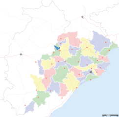
Orissa locator map |
||
| Description |
Locator map for the Indian state of w:Orissa. Equirectangular projection - Geographic limits of the map: top=24.27, bottom=17.691 |
||
| दिनाङ्क | |||
| स्रोतः |
स्वकार्यम् |
||
| रचियता |
|
||
| अनुमतिः (अस्याः सञ्चिकायाः पुनरुपयोगः) |
अहम्, अस्य कार्यस्य कृतिस्वाम्यवान्, अत्र अस्याः अनुमतिद्वारा प्रकाशयन् अस्मि : एषा सञ्चिका क्रिएटिव कॉमन्स-Attribution-Share Alike 3.0 Unported अनुमतिपत्रान्तर्गततया अस्ति ।
|
||
| Geotemporal data | |||
| Date depicted | second half of 20 century तथा च 21 century | ||
| Georeferencing | If inappropriate please set warp_status = skip to hide. | ||
| Archival data | |||
| टिप्पणी | Part of WikiProject India Maps | ||
सञ्चिकायाः इतिहासः
सञ्चिका तत्समये कीदृशी आसीदिति द्रष्टुं दिनाङ्कः/समयः नुद्यताम् ।
| दिनाङ्कः/समयः | लघ्वाकृतिः | आयामाः | सदस्यः | टिप्पणी | |
|---|---|---|---|---|---|
| वर्तमानः | १७:२८, ६ सेप्टेम्बर् २००८ | | २,२६९ × २,२४१ (२११ KB) | Planemad | |
| १३:२८, २१ फेब्रवरी २००८ |  | ६४७ × ५६४ (१३२ KB) | Mkeranat~commonswiki | {{Information |Description=Locator map for the state of [w:Orissa] updated to show white borders for districts |Source=self-made, based on India locator map by [w:User:Planemad] |Date=Feb 2008 |Author= Mkeranat |Permission= |other_versions= }} | |
| २१:३२, १४ फेब्रवरी २००८ |  | ६४७ × ५६४ (१३० KB) | Mkeranat~commonswiki | {{Information |Description=Locator map for the state of [w:Orissa] |Source=self-made, based on India locator map by [w:User:Planemad] |Date=Feb 2008 |Author= Mkeranat |Permission= |other_versions= }} |
सञ्चिकायाः उपयोगः
अधोलिखितानि 3 पृष्ठानि इदं संचिकां प्रति संबंधनं कुर्वन्ति।
वैश्विकसञ्चिकायाः उपयोगः
एतां सञ्चिकाम् अधोनिर्दिष्टाः वीक्यः उपयुञ्जते:
- ar.wikipedia.org इत्यस्मिन् उपयोगः
- as.wikipedia.org इत्यस्मिन् उपयोगः
- awa.wikipedia.org इत्यस्मिन् उपयोगः
- ba.wikipedia.org इत्यस्मिन् उपयोगः
- ceb.wikipedia.org इत्यस्मिन् उपयोगः
- de.wikipedia.org इत्यस्मिन् उपयोगः
- en.wikipedia.org इत्यस्मिन् उपयोगः
- es.wikipedia.org इत्यस्मिन् उपयोगः
- fa.wikipedia.org इत्यस्मिन् उपयोगः
- gu.wikipedia.org इत्यस्मिन् उपयोगः
- hi.wikipedia.org इत्यस्मिन् उपयोगः
- नलबण पक्षी अभयारण्य
- साँचा:ओड़िशा के लोकसभा निर्वाचन क्षेत्र
- आस्का लोक सभा निर्वाचन क्षेत्र
- भुवनेश्वर लोक सभा निर्वाचन क्षेत्र
- बलांगिर लोक सभा निर्वाचन क्षेत्र
- कटक लोक सभा निर्वाचन क्षेत्र
- ढेंकानाल लोक सभा निर्वाचन क्षेत्र
- जगतसिंहपुर लोक सभा निर्वाचन क्षेत्र
- जाजपुर लोक सभा निर्वाचन क्षेत्र
- कलाहांडी लोक सभा निर्वाचन क्षेत्र
- कंधमाल लोक सभा निर्वाचन क्षेत्र
अस्याः सञ्चिकायाः वैश्विकोपयोगस्य अधिकविवरणम् दृश्यताम् ।