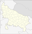
सञ्चिका:India Uttar Pradesh districts.svg

पृष्ठ की सामग्री दूसरी भाषाओं में उपलब्ध नहीं है।
विकिपीडिया, कश्चन स्वतन्त्रः विश्वकोशः

मूलसञ्चिका(SVG सञ्चिका, साधारणं २,३७९ × २,४६६ चित्राणवः (pixels), सञ्चिकायाः आकारः : १२२ KB)

Wikimedia Commons इत्यतः उद्धृता एषा सञ्चिका अन्येषु प्रकल्पेषु उपयोगार्हा । अस्याः सञ्चिकायाः सञ्चिकाविवरणपृष्ठम् इत्यत्र उपलभ्यमानं विवरणम् अधोलिखितं वर्तते ।

वर्णनम्
English: Locator map of the districts of Uttar Pradesh, India. Based on File:Uttar Pradesh locator map.svg
दिनाङ्क (UTC)
स्रोतः
लेखकः
अन्यानि संस्करणानि Derivative works of this file:  India Uttar Pradesh districts 2010.svg
अहम्, अस्य कार्यस्य कृतिस्वाम्यवान्, अत्र अस्याः अनुमतिद्वारा प्रकाशयन् अस्मि :
इदं कार्यं अत्र योजितं सार्वजनिकक्षेत्रम् अस्य कर्त्रा, Example, at the [[::|आङ्ग्लभाषा विकिपीडिया]] project । इदं जागतिकस्तरे आन्वितं भवति ।

In case this is not legally possible:
निर्बन्धं विना अस्याः कृतेः उपयोगं यःकोपि कस्यापि निमित्तं उपयोक्तुम् अनुमतिं Example यच्छति न्यायविधेः निर्बन्धः यदि न स्यात् ।

मूलनिवेशनप्रणाली

This image is a derivative work of the following images:

  • File:Uttar_Pradesh_locator_map.svg licensed with PD-user-w
    • 2009-11-05T21:34:09Z File Upload Bot (Magnus Manske) 2400x2515 (140024 Bytes) {{BotMoveToCommons|en.wikipedia|year={{subst:CURRENTYEAR}}|month={{subst:CURRENTMONTHNAME}}|day={{subst:CURRENTDAY}}}} {{Information |Description={{en|This map has been created by [[:en:User:Faizhaider|Faiz Haider]], it is b

Uploaded with derivativeFX

Captions

Add a one-line explanation of what this file represents

Items portrayed in this file

चित्रण हिन्दी

१२ नवेम्बर् 2010

सञ्चिकायाः इतिहासः

सञ्चिका तत्समये कीदृशी आसीदिति द्रष्टुं दिनाङ्कः/समयः नुद्यताम् ।

दिनाङ्कः/समयःलघ्वाकृतिःआयामाःसदस्यःटिप्पणी
वर्तमानः२२:१५, १३ नवेम्बर् २०१०२२:१५, १३ नवेम्बर् २०१० समये विद्यमानायाः आवृत्तेः अंगुष्ठनखाकारः२,३७९ × २,४६६ (१२२ KB)Pitichinacciocosmetics
१७:२३, १३ नवेम्बर् २०१०१७:२३, १३ नवेम्बर् २०१० समये विद्यमानायाः आवृत्तेः अंगुष्ठनखाकारः२,४०० × २,५१५ (१०७ KB)NordNordWestupd
१८:१६, १२ नवेम्बर् २०१०१८:१६, १२ नवेम्बर् २०१० समये विद्यमानायाः आवृत्तेः अंगुष्ठनखाकारः२,४०० × २,५१५ (१०७ KB)BishkekRocks{{Information |Description={{en|Locator map of the districts of Uttar Pradesh, India. Based on File:Uttar Pradesh locator map.svg}} |Source=*File:Uttar_Pradesh_locator_map.svg |Date=2010-11-12 18:15 (UTC) |Author=*[[:File:Uttar_Pradesh_locator_

अनया सञ्चिकया सह न किमपि पृष्ठं सल्लग्नम् अस्ति

वैश्विकसञ्चिकायाः उपयोगः

एतां सञ्चिकाम् अधोनिर्दिष्टाः वीक्यः उपयुञ्जते:

"https://sa.wikipedia.org/wiki/सञ्चिका:India_Uttar_Pradesh_districts.svg" इत्यस्माद् प्रतिप्राप्तम्