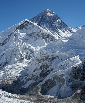
देवगिरि शिखरम्
दिखावट
| देवगिरी शिखरम् | |
|---|---|
|
आङ्ग्ल: Mt. Everest नेपाली: सगरमाथा Chomolungma Qomolangma ཇོ་མོ་གླང་མ 珠穆朗玛峰 | |
 एवरेस्ट्-शिखरस्य दृश्यम् | |
| उत्तुङ्गता |
८,८४८.८६ m (२९,०३२ ft)[१] Ranked 1st |
| Prominence |
८,८४८ m (२९,०२९ ft) Notice special definition for Everest. |
| Listing |
Seven Summits Eight-thousander Country high point Ultra |
| स्थानम् | |
| स्थानम् |
फलकम्:Country data NEP सोलुखुम्बु मण्डल, सगरमाथा अञ्चल, Nepal फलकम्:Country data PRC Tingri County, Xigazê Prefecture, Tibet Autonomous Region, People's Republic of China[२] |
| श्रेणी | महालङ्गुर हिम श्रृङ्खला |
| Coordinates | २७°५९′१७″ उत्तरदिक् ८६°५५′३१″ पूर्वदिक् / 27.98806°उत्तरदिक् 86.92528°पूर्वदिक्निर्देशाङ्कः : २७°५९′१७″ उत्तरदिक् ८६°५५′३१″ पूर्वदिक् / 27.98806°उत्तरदिक् 86.92528°पूर्वदिक्[३] |
| आरोहणम् | |
| प्रथमारोहणम् |
29 May 1953 फलकम्:Country data NEP तेन्जिङ नोर्गे शेर्पा |
| सुलभतमः मार्गः | साउथकोल (नेपाल) |
देवगिरी शिखरम् (नेपाली सगरमाथा; आङ्ङलभाषा माउण्ट एभरेष्ट; तिब्बतीः चोमोलोङ्मा) इत्येतत् विश्वस्य सर्वोन्नतः शिखरः अस्ति। अयं नेपाल-देशे स्थितः अस्ति। देवगिरि शिखरस्य सर्वोन्नत प्रमाणित मापन ८८४८.८६ मीटर २९०३२ फीट अस्ति।[४]
सन्दर्भाः
[सम्पादयतु]- ↑ Based on elevation of snow cap, not rock head. For more details, see Measurement.
- ↑ The position of the summit of Everest on the international border is clearly shown on detailed topographic mapping, including official Nepalese mapping.
- ↑ The WGS84 coordinates given here were calculated using detailed topographic mapping and are in agreement with adventurestats. They are unlikely to be in error by more than 2". Coordinates showing Everest to be more than a minute further east that appeared on this page until recently, and still appear in Wikipedia in several other languages, are incorrect.
- ↑ "Mount Everest is two feet taller, China and Nepal announce". National Geographic. Unknown parameter
|access-date=ignored (help); Unknown parameter|url-status=ignored (help)
